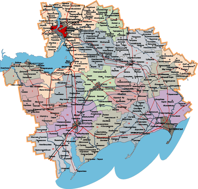
Region's Map
Architecture
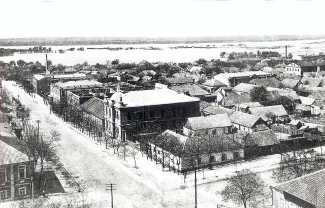
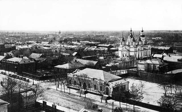
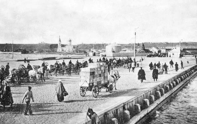
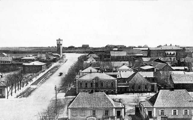
Gallery
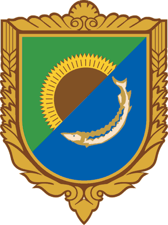
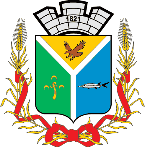
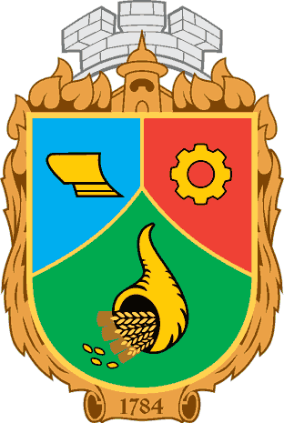
Districts:
Dear Reader,
This Illustrated Encyclopedia is the first detailed project, concerning one of the regions in Ukraine. Dike Pole Publishers brought together knowledge and skills of researchers, experts, photographers and writers and so was made this book.
As a result, we for ourselves could see and believed clearly in what a wonderful area we lived. There are seas and forestry, ancient mountains and spots of sand desert, rivers and lakes and a steppe… We have almost all microclimate types and species of European fauna, flora and live in one of the most developed regions in Ukraine.
We illustrated this in the Encyclopedia and tried hard to point out the history of this region, retraced clearly through millennia. We think we did the best we could and made it good. Our general task is — to bring a feeling of a personal visit to Zaporozhia region to one who is looking through this Encyclopedia.
Enjoy when turning its pages, please.
Service
Please use pictures and JavaScript in Internet Explorer 5.+ or Opera 8+.
Новости
01.03.08 — start the project
04.03.08 — first edition
07.03.08 — end the project
Soon...
Map Of Zaporozhye Region
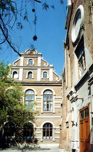
Architecture
Now we can’t see ancient architecture of Zaporozhia land as the whole — neither towns of Royal Scythians nor of Golden Horde, neither Bayda Wishnevetsky castle nor Nogai mosques. Time took a heavy toll and the 20-th century was the most destructive. Thousands of fine provincial architecture pieces built in 18-20 centuries are safe and well in this region now nevertheless.
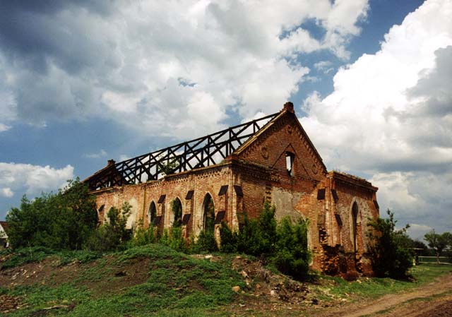
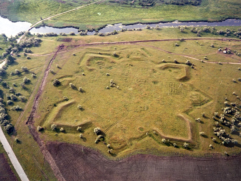
Fotrtresses Of Dniprovska Line
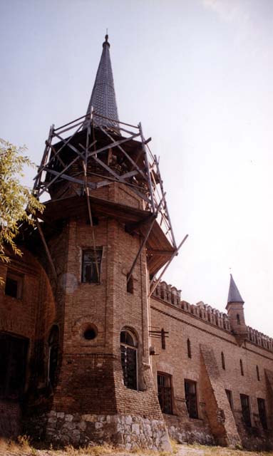
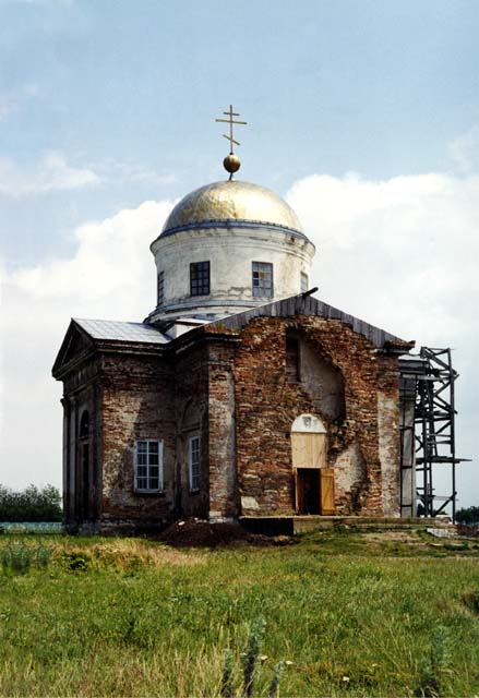
The 18-th century defence architecture monuments are Dniprovska fortification line debris. Empress Katherine II the Great signed the decree of its erection on May 10. 1770. M. A. Dedenev, prominent Russian fortifier, started layout and groundworks for the line in the summer already. Every each fortress had its own design but all were star-shaped. Ruins of five fortresses one can see today. Kirilivska citadel earthen bank is among Semenivka village households in Polohivsky district. Nikitinska’s star is between the railroad and the highway near Komishuvakha town. Bilotserkovka and Novopetrovka villages include the ruins of Alexeyivska and Petrovska ones. Zakharyivska fortress standing by Kalaytanivka village on the Berda River is the only one under state protection possesing status of an “architecture monument”. Alexandovska fortress covered 100 ha near the Dry Moskovka River (Red Water now) and was star-shaped also.
Its structure looked so: distant aproaches had a glissade, berme, moat and parapet; bastions protected the fort from three land lines but the Dnieper side was protected by a grubble groin and raveline. 137 guns defended the fortress. Inside territory had 8 big soldiers’ barracks, hospital, apotheca, warehouse and a school. The Councillor of the Court A. Shalaghin projected houses for higher rank officers. All buildings had stylistics of the epoch - barocco meeting classicism. We can know this just due to its sketchplan made by Alexandrovsk municipal architect F.C. Pikutovsky in 1894. Zaporizhia state archive keeps this paper. The fortress area was developing through the19-th century with no attention to its military meaning. Ramparts contours were clearly seen in 1913 still. They were razed in the 1970-s when the house blocks took the place.

Plan of Olexandrivsk fortress built in 1770
Today view of Mikitivska fortress remnants
Civil Building Origins
The Dnieper Line lost its military reason in the 1798, although strict planning for every settlement was tradition since. Alexandrovsk one’s plan of 1795 had conception for the future town growing. Classical pattern with rectangular streets net that cut the space in blocks was applied. The town had broad avenues, accents on market and cathedral squares, shady gardens and boulevards. Regular plan was given also to the Orikhiv village when it has got the town status in 1801. They kept this interesting paper in the town council archive over a century but it disappeared during the Civil War of 1918-21 when Red Army 885-th Brigade comendant has got it in his hands.
Smaller villages went under strict planning in the early 1900-s. Alexandrovsk Zemstvo council passed the resolution “About the inner structure and maintenance of settlements of the Katherinoslavska province” in 1910. All plans had had to be considered and signed by the governor and Zemstvo. Such a document directed not only where a church must be erected, but what kind of trees have to be planted either.
Mansion Architecture
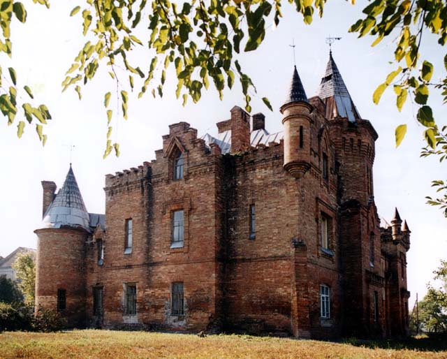
Most of estates were demolished during the Civil War. The Popov Castle, survived in Wasilivka town, is the best diamond though. Architect Alexander Ageyenko built it in 1889-94. The complex consisted of palace, fortress wall and towers, chapel, viewing tower, greenhouse, observatory and meteorology station. Marble satues decorated the garden paths. Pseudo Moresque eastern and northern wings were for guests. There were traditional Russian, Turkish and Finnish baths in the basement. Neogothic western wing was used by servants. Architect Nikolay Benoi projected the stable in the North Italian style of the Middle Ages. There were 15 ethnographical rooms (Turkish, Japanees, Indian etc), fine art and arms collection and large library of rare volumes and manuscripts. Mansion construction cost 1.5 mln rubles in silver. Multitype bricks and other materials were locally produced but timber for ball-hall floor was brought from Australia. The castle fascinated a viewer with its harmony despite of all its eclectic features. The art pictures of Popov Castle were printed and sold in Russia, France, Germany and Great Britain. Its project was put on the honorable pages in “Peterbourgh Institute of Civil Engineers Jubilee Book”. One can see traces of Popov Castle, although it lost among apartment blocks and gardens of today.
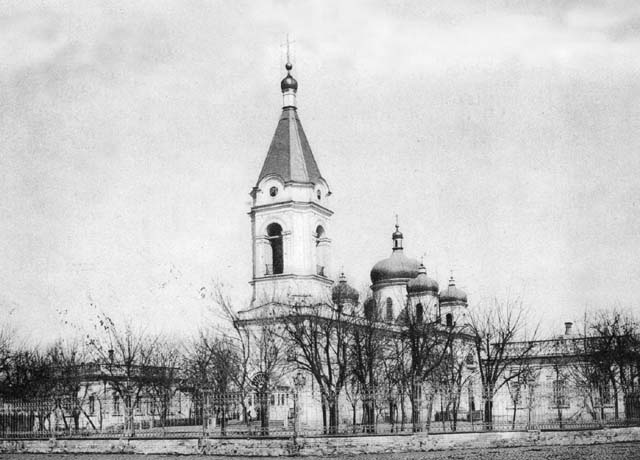
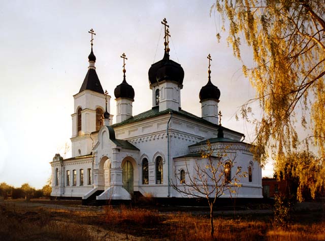
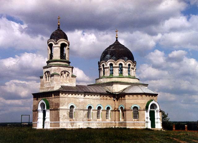
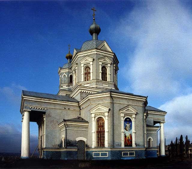
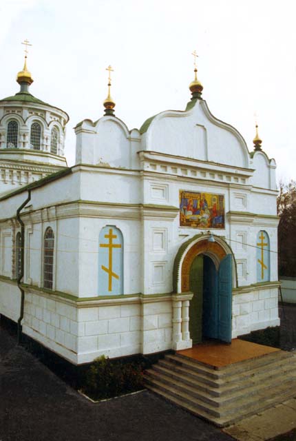
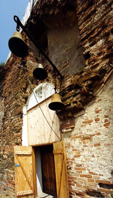
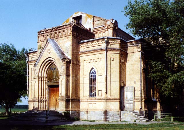
Cult Architecture
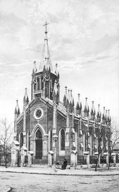
Since every settlement had cult buildings their domes and bell towers answered for dominating hights for an area and cathedral squares were main accents in rural and town development. Cult architecture suffered the most loss in 1920—40. Pokrovsky cathedral and Woznesenivska church in Zaporizhia, Orikhiv church, Upper Khortitsa kirk, Melitopole Alexader Nevsky cathedral and a lot of others were blown up during communist party “antireligious war”. There are some survived as yet. Count Orlov-Denisov built Troitska (Trinity) church in 1838 in memory of 1812 Russia-Napoleone war in his village that’s inner town of Primorsk now. Among interesting survivors are churches in Kinsky Rozdory, Maryivka, Weselianka, Kamyanka-Dniprovska and Upper Tokmak villages. All were built in Russian-Byzantine classical style but every one posseses its own silhouette. Architect Agheyenko also built churches and belfries in 1888—89. There are his ones in Gunevka, Novopavlivka, Fedirivka, Volodimirivka and Youz kuy villages and in Berdyansk.
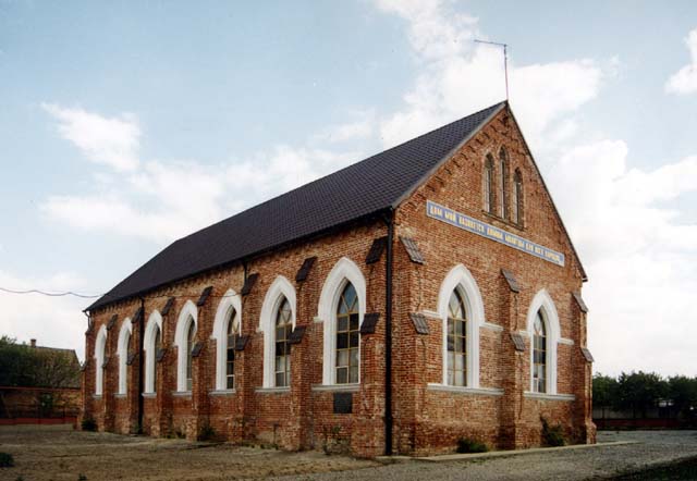
Protestant churches are saved in old Mennonites colonies. These pseudogothic silhouettes decorate Kutuzivka, Luhivka, Kozolughivka and Snihurivka villagescapes of former Galbstadt Mennonites district (Molochansk now). Large Lutheran kirk and a German school with it were built in the 19-th century in Berdyansk. It’s almost unchanged after 1901 reconstruction and is used as one of Berdyansk Pedagogical Institute auditorium now.
Synagogues one can see in Zelenopole village, in Zaporizhia City, Berdyansk and Melitopole. Alone saved in this region, Karaite kenassa built in 1850 in the pseudobarocco style, is saved in Berdyansk. Isn’t it ironic that a sports club, its building owner about 70 last years, obviously saved it from demolition.
Berdyansky District
Eleven rivers flow through its territory to the Azov Sea, the biggest are the Berda and the Obitichna. Soils around here are the black earth mainly, so Berdyansk district is an agriculturally developed one. Wheat, maize, sunflowers, barley and melons are the best cultures for this climate. "Agrofirm Niva" is the biggest producer and seller. in these steppes. Traditional through milleniums sheep breeding revived in the last years here also.
Districts countryside has good sport schools and clubs, 24 culture clubs, 7 museums.
Berdyansky district has 43 historical and 234 archaeological sites under state protection. Among them Scythian and Cuman stone figures, barrows of IV c. B.C. - XIV c. A.D, fortresses from Russia-Turkey wars of 1768-1774.
Novopetrivka, Lunacharske, Dmitrivka villages on the nice Azov seashore are popular health resorts of Ukraine.
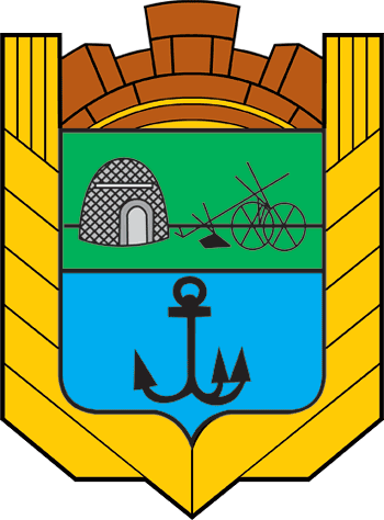
Wasylivsky District
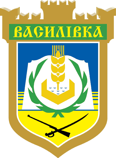
Wasilivsky district today has a 1621 sq. km territory, where 73300 people live in 35 villages and 2 towns - Wasilivka (15400 persons), Dniprorudne (20700). 83% of district land is blackearth soil. Sunflowers, grain, melons and vegetables are top agricultures. Local climate helps to grow them - warm weather is over 215 days a year.
1/7 of the Kakhovske artificial sea area belongs to this district. Yan-Chokrak, Kara-Chokrak, Konka and Bilozerka rivers cross this territory. 4900 ha of it are covered with forest.
Industrial and Agricultural vocational colleges work in Dniprorudne town and in the district's capital Wasilivka. Due to the lots of mineral resources the mining industry is the most developed. There are iron and manganese ores, sandstone, clays and limestone. Machinebuilding, constructing and metallist businesses work too.
The landlord's palace, service buildings and a part of the old garden are the state museum "Popov's Estate" now. Archaeological museum of interesting local findings work in the Balky village. Over 373 ancient barrows are registered and wait for their exploreres in this district. Wild nature reserves of the Kuchugury Islands archipelago on the Dnieper river, Lisa Gora (Bald Hill), an ornitology reserve and some others are also under state protection in this district.
Welykobilozersky District
In 1736 during the Russia-Turkey war a fort by a ford across Bilozerka river was built by the Zaporozhia Cossacks. Peasants from a Central Ukrainian region of Poltava established Welika (Great) Bilozerka village in 1778. There are many ancient tumuli in this district, chiefly, the chains of the Royal Scythian barrows along the Bilozerka riverdale.
The district was abandoned in 1962 and reestablished in 1993. Now it occupies 470 sq km, where 93000 people live. Welyko-Bilozersky district is mainly agricultural having a powerful irrigation system built in the 1970-s. Grain and sunflower growing, fruit and vegetable gardening are local specialties.
There are 3 secondary schools, an aesthetic upbringing school, a creative house, 7 culture clubs, 7 libraries (60000 books), a museum of local history. Central district hospital and 7 local clinics in the countryside provide health care.
Rather good sport hunting places are along Bilozerka river that disgorges into the Bile (White) lake. Naturally, the fishing is good also. Graceful white swans gave their name to this country.
Weselivsky District

Black earth soil and warm climate are good for wheat, barley and sunflower growing. Local farmers breed meat/milk cattle also. Beside foodgrain producing farms there are researching ones too - elite grain-seed growing. Naturally, the mostly paying here are foodprocessing enterprises and agri-technical services.
22 secondary schools attend over 4400 pupils. Children are happy with their Young Tourist-Scouts Club, many of them educate in local musical school or visit the arts house. Graduates of Wesele technical school №60 work in industrial, agricultural and service businesses of this district.
22 libraries, 19 culture clubs and a good museum of local history are in this district. Folk ensemble "Ukrainochka", a vocal group "Barvinok" and an amateur drama company of Novouspenivka village have the honorary title "People's".
The Sport School of Wesele is proud of its free-style wrestlers - Yury Semakin and Inessa Reber are many times champions of Ukraine and Europe. International free style wrestling contest is in Wesele every year.
There are 82 archaeologically essential sites; some especially famous burials of IV c. B.C. - III-IV centuries A.D. are registered on the Weselivsky district territory.
Wilnyansky District

In 107 villages 50689 people live and 34233 of them are in Wilnyansk town.
Wilnyansky mineral resources have brown coal, kaolin, constructing and facing granite. The most developed agriculture lines are graingrowing (70%) and cattlebreeding (30%). Over 200 private farms and ten industrial enterprises work in the district. "Taras Shevchenko" factory (since 1870) is the biggest one in Wilnyansk. It is famous for its general products - high-finished stainless steel tableware. More than 4000 workers are employed in this district.
Wilnyansky is known in Ukraine as a "singing" district. A dozen of teens' pop-starlets has gone professional from local clubs. No surprise - Ivan Patorzhinsky, the opera bass singer of the world fame was born here in Petro-Svistunovo village.
Gulaypole District
It has 20 schools, 27 libraries, many culture clubs.
In 1918-21 Gulaypole town was the heart of the biggest insurrection movement of peasants with the anarchist, Nestor Makhno, as its charismatic leader. He fought against the reds, the whites and the Ukrainian national forces in a vague hope to establish a free republic with no central government but his army was destroyed. Makhno died as an emigree in Paris in 1934. Now Gulaypole museum has a memorial plaque and a detailed exposition dedicated to "Father" Makhno Insurgent Army.
Zaporizky District
Social-cultural infrastructure here covers 24 schools, 7 kindergartens, 57 culture clubs and 42 medical institutions.
Zaporizky district is in the best place of this region, the nearest to the big city with its developed transport system - motorways, railroads, a river and airports. Hard-working people and black earth of this land are really worthy to invest in. Any potential partners who are interested in new agricultural technologies development here are welcome in Zaporizky rural district.
Kamenka-Dniprovsky District

Kujbyshevsky District

Melitopolsky District
Mihajlovsky District
Priazovsky District
Primorsky District
Rozovsky District

Tokmaksky District
Chernigovsky District